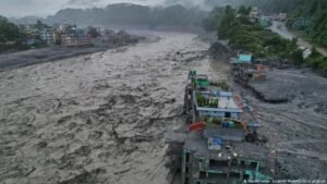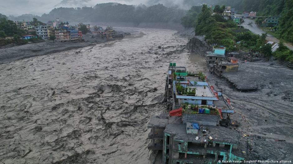
Nearly 1,400 people have died after a mountain slope collapsed and flash floods swept through the valleys of Nepal and Tibet. More than 5,000 people remain missing.
The collapse was initially thought to have been caused by an earthquake. Now, glaciologists and climate scientists have determined that a complex series of factors led to the disaster, with climate change laying the groundwork several times over: Warming temperatures receded the glacier, thawed permafrost and increased meltwater, destabilizing the slope until it gave way on August 26.
“This was not a single trigger event,” Walter Immerzeel, a mountain hydrologist at Utrecht University in the Netherlands, told journalists on a press call. “The failure occurred at an elevation of about 5150 meters (about 16,896 feet) and there were several processes acting together over time scales of years to decades, rather than one factor acting alone.”
How the disaster unfolded
The floods began upstream with a large rock avalanche on the north face of Langtang Lirung. That caused a section of the glacier to collapse at the same time, sending roughly 110 million cubic meters of rock and glacier ice, the size of 44,000 Olympic swimming pools, hurtling downward. That type of rock avalanche is rare, occurring at this size only once every 1,000-10,000 years.
The material fell about 1,400 meters (4,593 feet) from the mountain to the valley floor, picking up debris, water, ice, rock and sediment as it descended. The impact released as much energy as a magnitude 5.2 earthquake. As it crashed into the valley, it also tore up buried glacier ice, adding up to 30 million more cubic meters of debris and water to the flow.
Within about seven minutes, the flood reached Nepal and China’s Rasuwagadhi border, 20 kilometers (about 12 miles) downstream, moving at an average speed of 170 kilometers per hour (about 106 miles per hour). The flood continued downstream, traveling 200 kilometers in under seven hours.
How did this happen?
It was a complex combination of conditions, exacerbated by climate change, that allowed the slope to collapse in the first place. That’s according to researchers with World Weather Attribution, an international collaboration of scientists that looks at the role of climate change in extreme weather and disaster events.
Rising temperatures, due to the burning of fossil fuels, have reshaped this stretch of the Himalayas for decades.
Near the failure site, the glacier’s edge had retreated just 75 meters between 1964 and 2000. But between 2010 and 2026, it dramatically accelerated, retreating another 373 meters. That stripped away the ice supporting the rock wall above it.
Permafrost — or permanently frozen ground within the rock — had also started to thaw. That took place between 4,500 and 5,500 meters of elevation, a critical band that’s most sensitive to warming. As it thawed, the mountain walls became more and more unstable.
In the immediate run-up to the collapse, conditions were extreme. July and August overall were the warmest on record in the area, with climate change adding about 1.5 degrees Celsius (2.7 degrees Fahrenheit) to the region. On August 24 and 25, temperatures ran roughly 2.5 to 2.7 degrees Celsius above the 10-year average. A day before the catastrophe unfolded, the maximum temperature was approximately 7 degrees Celsius above the reference mean.
An unusually snowy October in 2025 likely also played a role, generating more meltwater.
Researchers also believe a 2015 earthquake played a role. That magnitude-7.8 quake triggered an earlier avalanche at Langtang Lirung, which may have weakened the rock mass in the years since, priming the slope for failure.
A disaster beyond adaptation
Researchers also tried to find out whether this was a disaster the region could have prepared for and adapted to. They determined it was uniquely hard to detect, as Nepal’s early warning systems are designed for forecastable rainfall-driven floods, not quickly developing, cascading events like this one.
Essentially, this kind of complex threat exceeds the limits of adaptation.
The flood outran Nepal’s early warning systems and destroyed several monitoring gauges in its wake. The first mass SMS warning was sent about 38 minutes after the initial collapse, but the flood had already reached the border 7 minutes in.
“When warming destabilizes the roof of the world, no amount of local adaptation can fully shield vulnerable people downstream from this scale of destruction,” Friederike Otto, professor of climate science at Imperial College London, said.
“Without much faster action to transition to zero fossil fuel emissions we will inevitably see more disasters of this scale occurring in the years to come.”
To view this video please enable JavaScript, and consider upgrading to a web browser that supports HTML5 video
Edited by: Sarah Steffen