Satellite images show bedrock and glacier collapsed on Nepal-China border, then rivers flooded
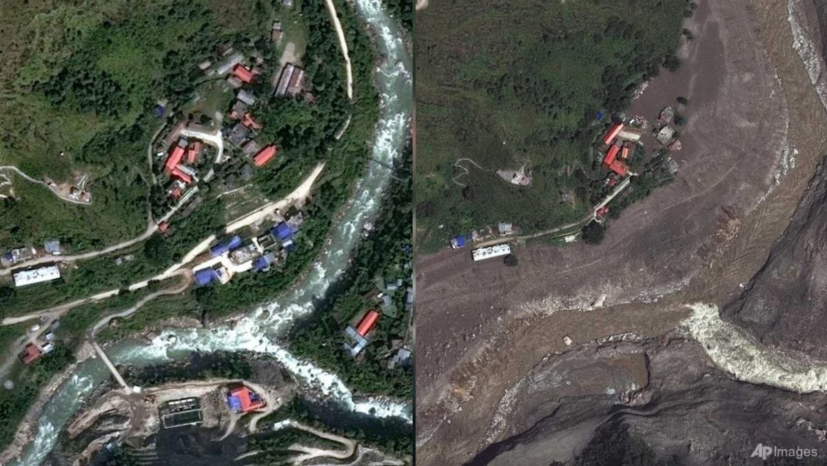
Satellite images before and after the disaster show where people were living and how the debris had buried villages.
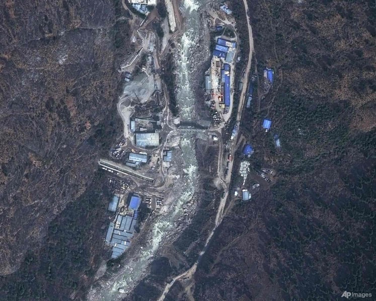
Satellite images provided by Vantor show destruction at Syapru Besi, Nepal on Oct 18, 2025 and Aug 27, 2026. (Images: AP/Vantor)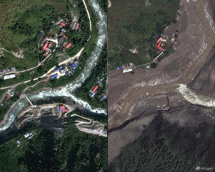
Read a summary of this article on FAST.
Get bite-sized news via a new
cards interface. Give it a try.
Click here to return to FAST
Tap here to return to FAST
FAST
As rescue teams searched for missing people following catastrophic flooding along the Nepal-China border, Earth scientists reviewed satellite imagery for clues to the cause and assessed the devastation.
The flooding on Wednesday (Aug 26) killed hundreds of people in Nepal and Tibet, and hundreds more are missing, including foreigners and pilgrims.
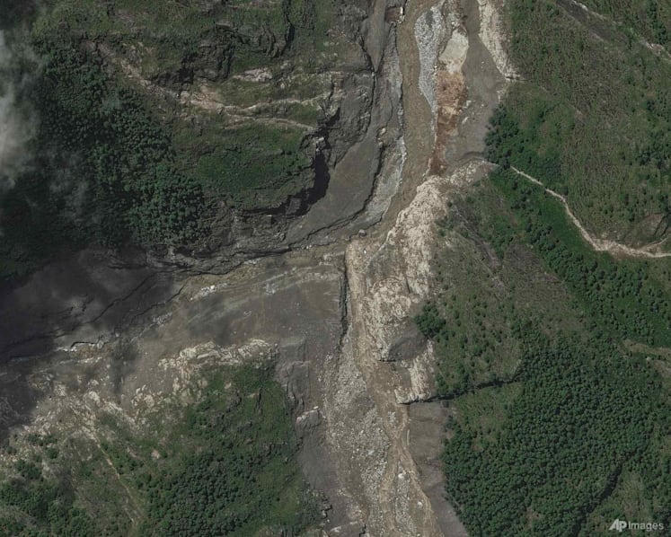
Geomorphologists Kristen Cook and Dan Shugar said initial images from Nepal were obscured by clouds and dust from the debris, so they could only see that part of a glacier had broken off from Langtang Lirung peak, near the border with Tibet.
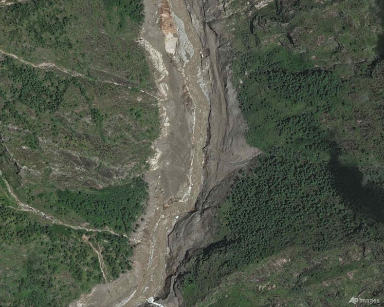
In clearer images from Thursday, they said they could see that the bedrock underneath the glacier had collapsed, taking the massive chunk of ice down with it and sending boulders and ice into the valley.
“It shows the whole area without anything hidden, and we could see that, yes, it looked like there was not only this glacier that had failed, but a much larger chunk of the bedrock of the mountainside itself that had given way,” said Shugar, associate professor at the University of Calgary.
“You have this big bedrock failure that took part of the glacier with it.”
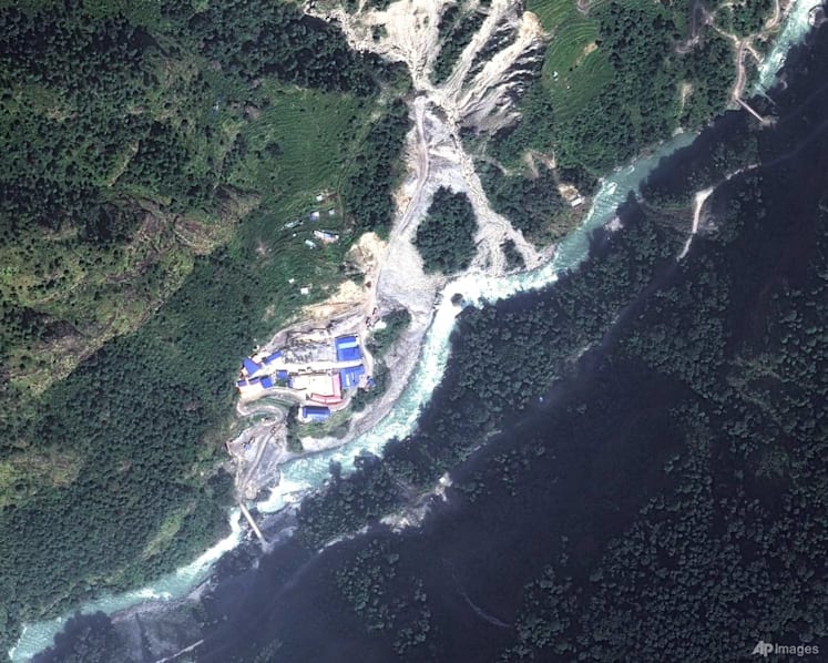
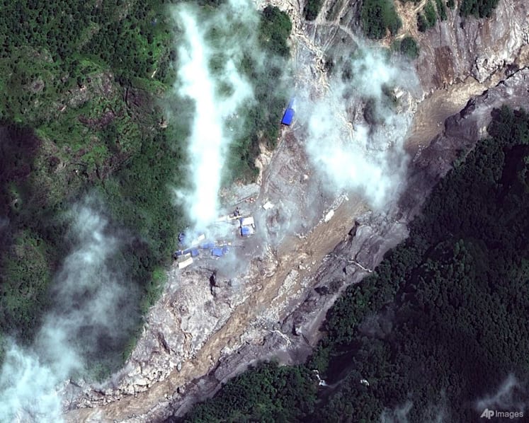
Shugar said that it was heart-wrenching to look downstream from there in the images, to where people were living, and see how the debris had buried villages.
After slamming to the valley floor, the debris maintained its momentum through the steep, narrow valley as ice melted, said Cook, at the Universite Grenoble Alpes in France. Water and mud several stories high swept through communities.
The Trishuli River surged during the flooding. Before and after satellite images of the Kolpurtar, Betrawati and Syapru Besi areas of Nepal show that the river is now much wider and brown and black, because it overtopped its banks in some areas and filled with debris in others.
The change in the colour of the water shows how much sediment the flow was carrying, turning from greenish to very brown because it’s full of mud, Cook said.
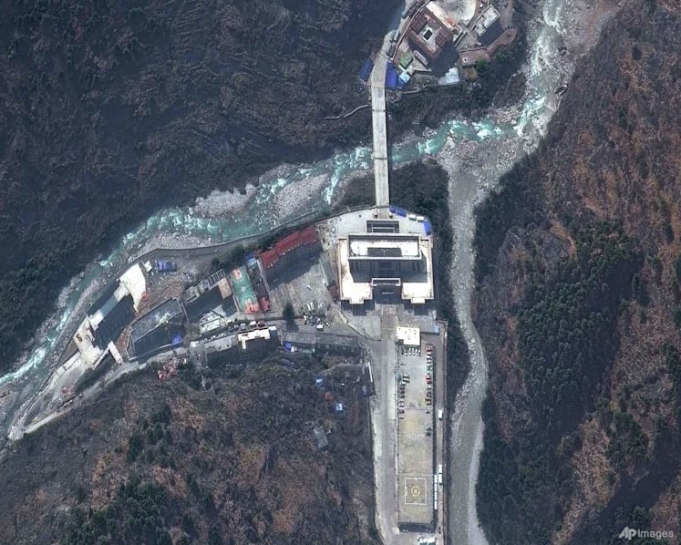
Towns and villages that were devastated along the river banks are submerged in debris and mud. They appear as areas of brown. Some houses are still poking through in an image of the Betrawati area.
The flooding toppled and swept away buildings in Syapru Besi, a popular tourist spot where a famous trek to Langtang begins. In before-and-after images, a side river is now wider too, because the flow was so powerful it pushed upstream.
The flooding “left a wasteland in its wake” that will take many years to recover from, said Alton Byers, a mountain geographer at the University of Colorado at Boulder. Byers lived in Nepal and now returns there yearly to study glacial hazards and work with communities to prepare. This is the largest glacier flood he has seen, by far.
Byers, a faculty research scientist at the university’s Institute of Arctic and Alpine Research, said he thinks Wednesday’s flooding is related to climate change. The Earth’s warming is melting glaciers and permafrost, causing instability and the breakage of massive amounts of snow and ice at high altitudes. That can be a catalyst for a series of cascading events, he said.
“All the indicators, to me, point to the impacts of warming trends,” he said. “In this case, the permafrost that for millennia has helped to hold together high-altitude rock and ice and soil and glaciers is now weakening and becoming unstable.”
Cook and Shugar said that at this point, they can’t say for sure there’s a direct link to climate change. Slopes fail, and landslides happen, Cook said, though permafrost is melting and that is destabilising mountainsides.
“While we cannot at this point directly link this collapse to climate change, it is not unexpected to see more events of this type with a warming climate,” Cook said. “Not this big, hopefully not this big.”

Source: AP/nh
Sign up for our newsletters

Get the CNA app
Stay updated with notifications for breaking news and our best stories
Get WhatsApp alerts
Join our channel for the top reads for the day on your preferred chat app

Get bite-sized news via a new
cards interface. Give it a try.
Click here to return to FAST
Tap here to return to FAST
FAST
About The Author